Summary
COMING SOON!
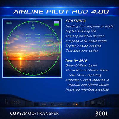
Version 4 of the Starland Airline Pilot HUD provides more vital at a glance information to help navigate the virtual skies. New information such as actual air to ground altitude, reporting of imperial altitudes used in some auto pilot systems and a visual warning when flying low enough to be impacted by general ban lines have been added to both the full display and minimized displays.
WHAT'S NEW
New features added in version 4 are incuded with emphasis on providing more valued detail to pilots. Information that will help with more accurate activities involving SAR and firefighting activities are a key part of this update. Below is a list of new features:
- Altitude data now includes imperial (feet) as well as metric (meters) values.
- New information added related to height above ground/water levels. (AGL/AWL).
- Indicator lamp showing whether flying over land or water.
- Low altitude alert lamp indicates when altitude has fallen below 50m AGL/AWL.
QUICK START
The HUD can be mostly used "out of the box" if default settings work for you. Use this method to get up and running quickly

- Wear/Add the HUD. It will attach to your center HUD area.
- Rez your aircraft.
- Obtain the UUID of the aircraft you are connecting the hud to. Alternatively, you can select "Avatar" and the HUD will report based on your avatar.
- Click "Aircraft" to allow you to enter the UUID of the airplane. You can also enter the name of the aircraft if you can't get the UUID. You must be the owner of the aircraft if you are using the name.
- The HUD will then open up and begin reporting based on which selection you made before.
FULL VIEW
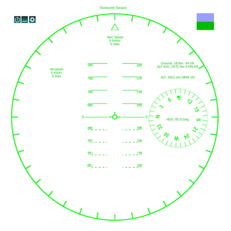
TOOLBAR
The tool bar on the top left corner has been reduced to three buttons. Settings that were done here have been moved to a settings page. The table below describes the buttons and their functions.
Activate/Deactivate the hud.
Opens HUD settings menu.

Open the settings page.
SETTINGS PANEL
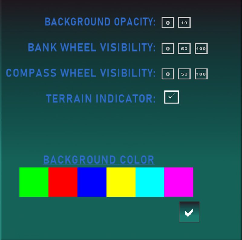
Settings panel allows personalizations to features of the HUD based on the your preferences.
- BACKGROUND OPACITY - Allows a clear background or a 10% opaque background. This can be used when environment conditions interfere with the visibiliy of the HUD.
- BANK WHEEL VISIBILITY - Allows reduction or elimination of the outer wheel of the HUD to improve visiblity.
- COMPASS WHEEL VISIBILITY - Allows reduction or elimination of the compass wheel (sometimes referred to as compass rose).
- TERRAIN INDICATOR - Turns the terrain indicator on or off on the main screen. Terrain indicator will still be visible on the minimized screen.
- BACKGROUND COLOR - Allows selection of a preferred color for the HUD.
Changes made on the settings panel are immediate. Press the Check box button to close the settings panel.
MINIMIZED VIEW
Minimized view closes all of the gauges on the page and shrinks the HUD to a small area near the top of your scree that presents text only flight data and the terrain indicator. In the image below, the button with the square icon returns the view to full screen.

VALUES EXPLAINED
Below table lays out the meaning and where appropriate the calculation for each reported indicator. All entries are based on the in-world scale.
Airspeed is reported in both meters per second (MPS) and knots (MPS * 1.94384). This may not match knots reported by aircraft as some creators have their own scale to simulate real world values.
Similar to Airspeed. Same data and calculations
Reported altitude above z=0. Reported in both metric (meters) and imperial (feet). Reporting in feet is done because international standard for altitude in aviation uses feet, as does some SL aircraft.
This reports the height of either water or ground based on what you are flying over at the time. The display will indicate which value is being shown.
Reports how high above the terrain you are flying. This will reflect AGL (Above Ground Level) or AWL (Above Water Level) depending on what you are flying over.
This displays a red indicator if you are flying below 50m AGL/AWL. This is the altitude where general ban lines might appear. If you are above 50m AGL/AWL, the indicator will be light blue. This indicator can be hidden from the full view, using the settings menu.
Lamp displays green if you are flying above land, blue if you are flying above water.